Uwaga Zwierzęta: a map of animal reports, a report from your phone in a minute
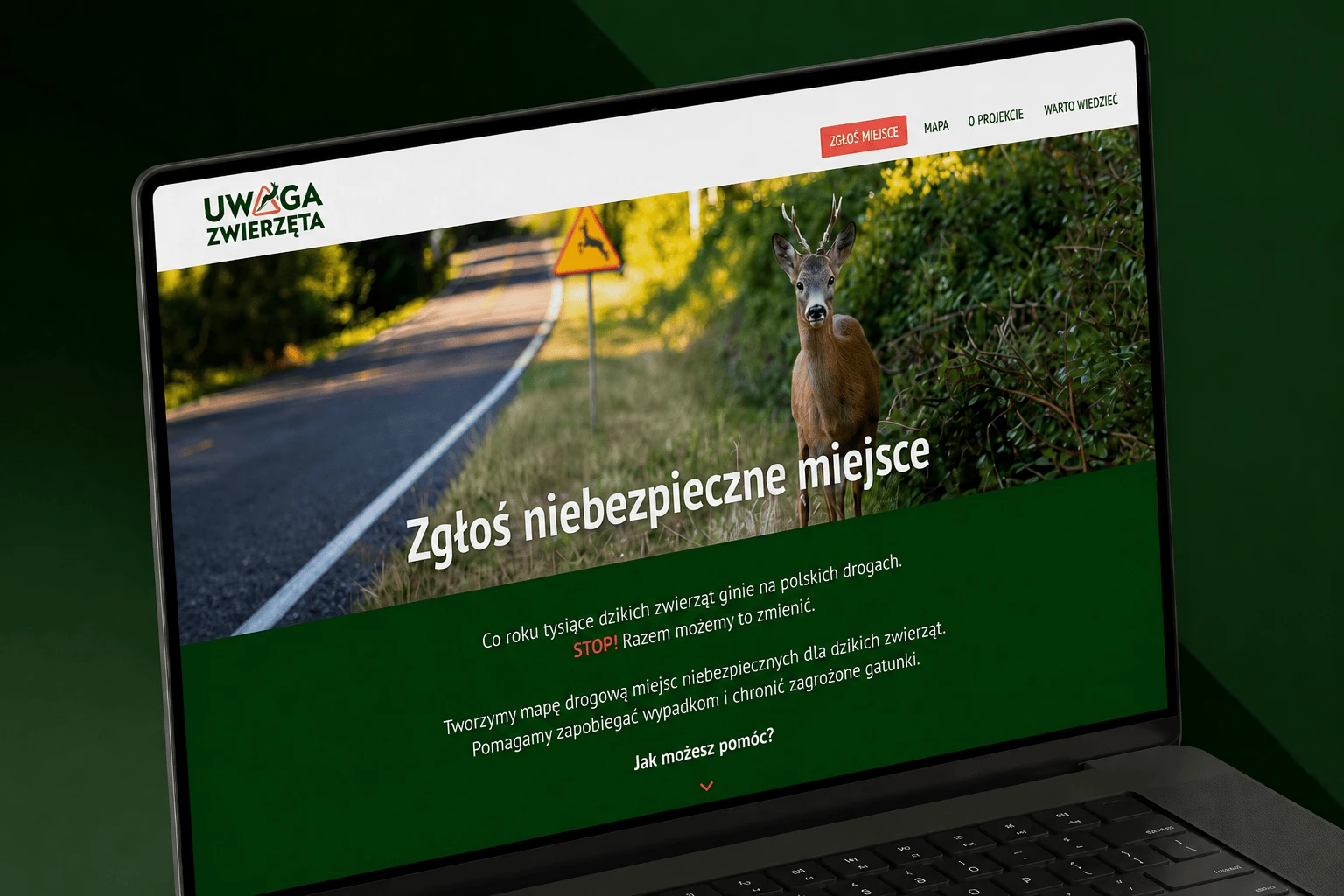
I designed and built a map application on WordPress. Reports go from the form straight onto the map, and drivers see the warnings in a clear view.
- Client
- Uwaga Zwierzęta, a community warning map
- Year
- 2026
- Scope
- Concept, WordPress, form, map, filters
- Made at
- Kiwwwi Studio
The challenge: a form used from the roadside and a map that stays readable with hundreds of points
Uwaga Zwierzęta (“Watch Out, Animals”) is a community project: an interactive map where anyone can report an animal seen by the road or the site of a collision. The reports build a shared warning map for drivers, which makes it easier to see the places where you need to slow down.
A report is made in a specific situation: the user is standing on the roadside with a phone in their hand. The form had to work in a minute, with one hand, without registration and without instructions, because the person reporting has no time for a long process at that moment.
The second part of the challenge was the map. With hundreds of points the view had to stay readable, and new reports had to reach the map automatically, with no manual handling by the editors.
- A report from the phone, with one hand, in a minute.
- No registration and no instructions. The form collects the data it needs without an account.
- Hundreds of points on the map, so the view needed clustering, filters and clear icons.
- Automatic publication. Once sent, a report appears on the map straight away.
The solution: a map application on WordPress with a short reporting path
I built a map application on WordPress, with a custom theme and a reporting path designed for the phone first. I connected the form, the map, the place search and the filters, so that a report immediately creates a point other drivers can see.
- Location from the map. The user picks the place by clicking on the map or through the Google Places search. The coordinates fill in automatically.
- A short form. A report covers the event type, the animal species, the date, the time and a photo. The layout leads through these fields without extra instructions.
- Automatic publication. A sent report becomes a point on the map straight away. The editors do not have to move data between the form and the map view.
- Point clustering. The map groups reports when there are many of them in one area. This keeps the view readable with a larger amount of data too.
- Custom event icons. One marker shows an animal by the road, another shows the site of a collision. The driver recognises the type of warning faster.
- Report filters. The user can narrow the view by event type and species. The map then shows only the points that match the chosen context.
- Phone-first design. I laid out the whole path, from landing on the site to sending the report, for the small screen first.
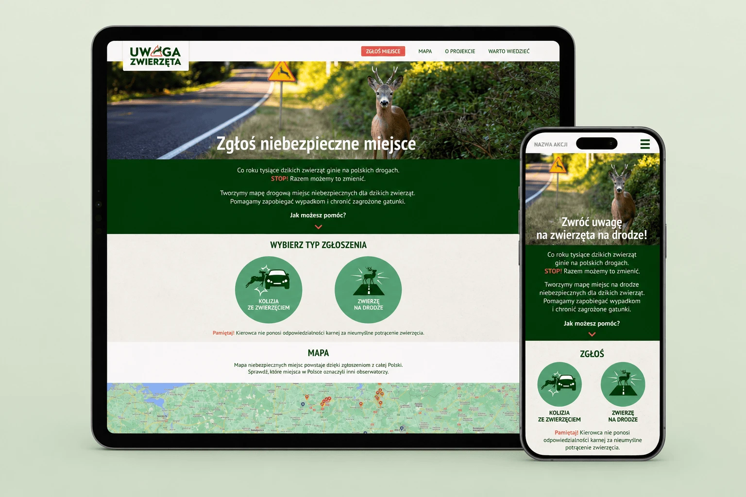
Fig. 1. The home page on a tablet and a phone with the place reporting screen. The mockup was made with the help of AI. The site shown is real.
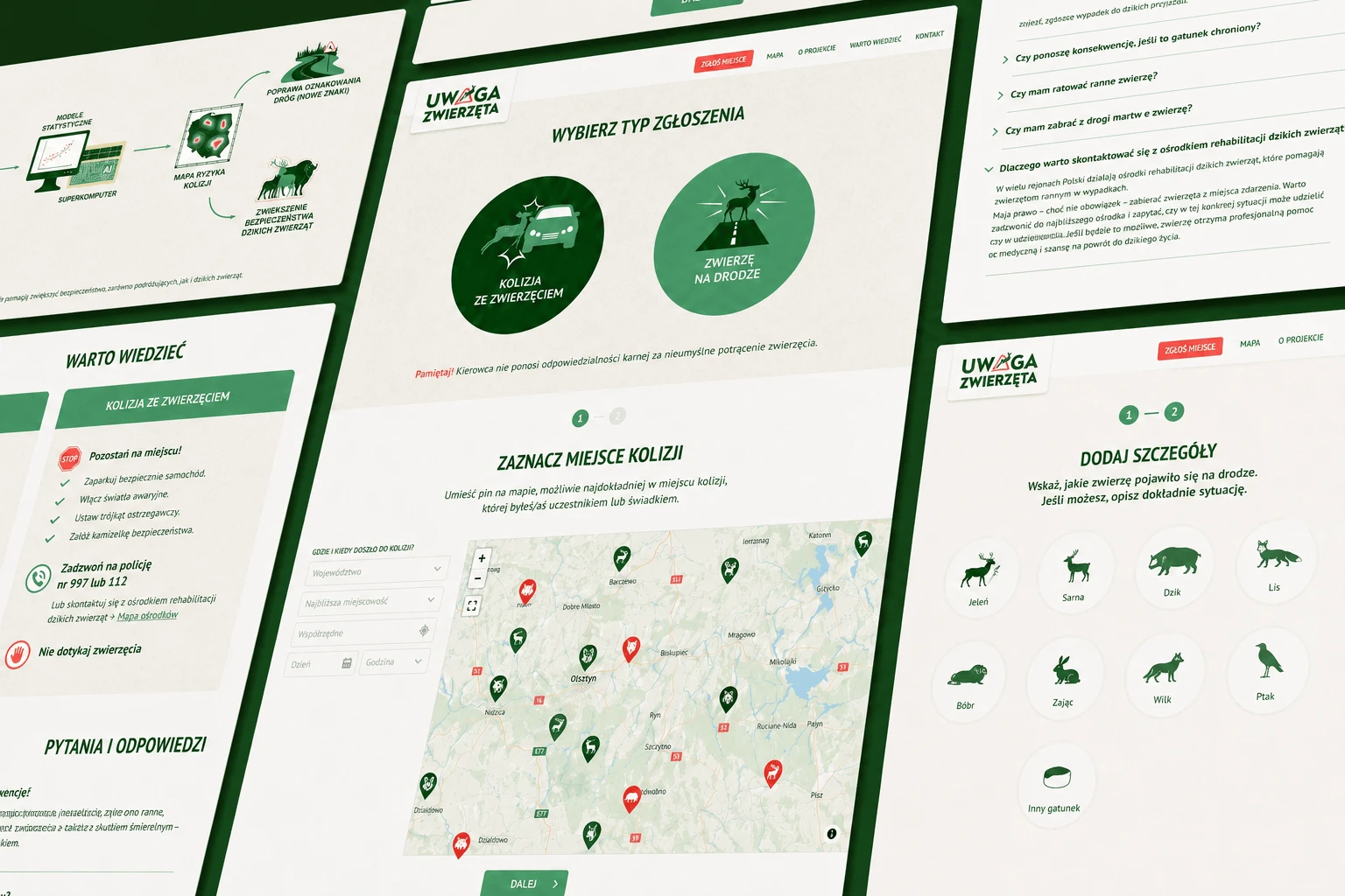
Fig. 2. The report form screens with the type choice, the map and the details. The mockup was made with the help of AI. The site shown is real.
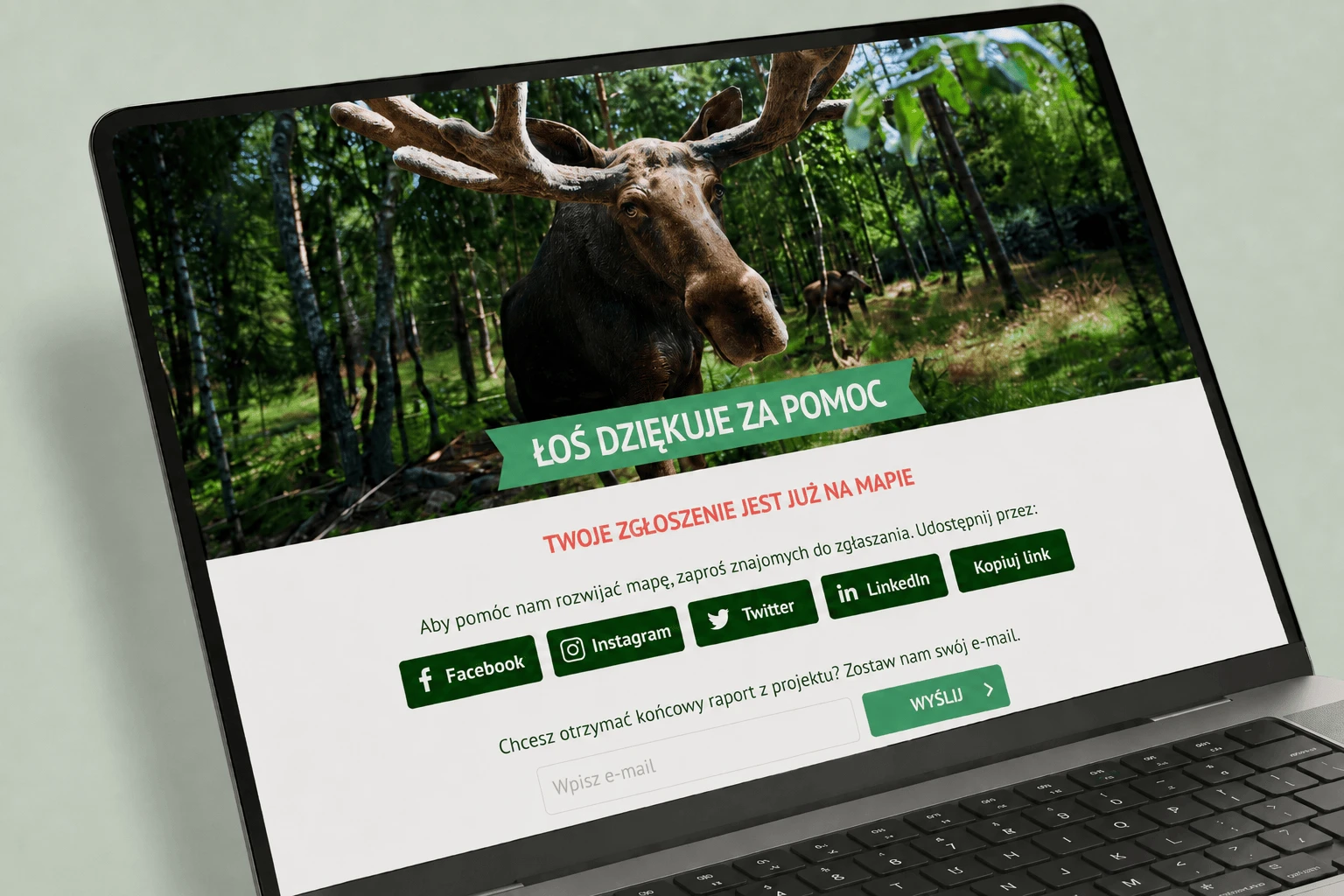
Fig. 3. The thank-you screen after sending a report in the Uwaga Zwierzęta application. The mockup was made with the help of AI. The site shown is real.
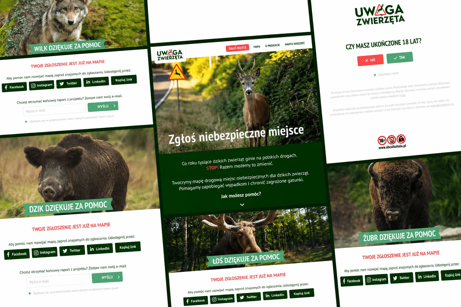
Fig. 4. Collage of the thank-you screens shown after reports for different species. The mockup was made with the help of AI. The site shown is real.
Scope of work
Next project